Twice each day, one hundred billion tons of seawater flow in and out of the Bay of Fundy. At low tide, huge expanses of ocean floor are exposed. At high tide, just six hours and 15 minutes later, the ocean reaches its highest point on the shore. The cycle from high tide through low tide and back to high tide again takes 12 hours and 30 minutes. With two high tides and two low tides every day (25 hours in total) the time of day for each high and low tide changes constantly. People refer to tide charts and tide clocks in order to know when the high and low tides will happen and to know whether the tide is coming in or going out.
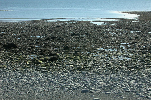
The high tide mark on the shore is easy to find: just look for the line of sea plants and driftwood deposited by the water when it peaked and then changed direction. The space between the high tide mark and low tide mark is the Intertidal Zone. It creates a very unique habitat: the plants and creatures that live there are under water half the time and exposed to the air the rest of the time. Mud shrimp, clams, crabs, periwinkles and barnacles are the creatures of the intertidal zone.
On the high edge of the sloping beach, there are hardy seashore grasses and flowering plants like the Beach Pea. On the lower extreme of the beach you will find the algae, such as rockweed, seaweed, kelp, irish moss and dulse.
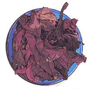
The reddish/purple seaweed, Palmaria Palmata, that we call dulse is edible and it is very good for you. It has all the trace elements humans need to survive. Dulse is high in protein and iodine, and when it is dried it has a nice salty flavour. One travel writer said: “It tastes like how a sunny fishing village smells.” You can buy dried dulse in local stores. Cooks add dried dulse flakes to their soups and stews, and they serve it as a side dish like any vegetable.
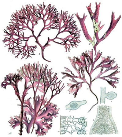
There are a number of seaweed species along this coast that are harvested commercially. Irish moss, Chondus crispus, is valuable because of its absorbency. It can hold up to 30 times its weight in water. You’ve probably seen the word ‘carageenan’ in ingredients lists on packaging. That is Irish moss’ active ingredient, essentially a kind of gel. It’s used as a thickener in ice cream, chocolate milk, toothpaste, air-fresheners and many other products.
There was one other important food from the intertidal zone that was useful to the Acadians when they first arrived here – the Atlantic surf clam, Spisula solidissima. It was such a reliable food source that it prompted the first settlers to build their homes near the coast. Surf clams are large mollusks and they live buried in the sand all over these beaches particularly on the stretch of coastline north of Le Petit Bois as far as Belliveau’s Cove. The next village north of here – Grosses Coques (big clams) – is named after these creatures.
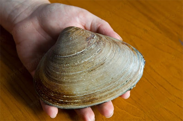
The surf clams have a long tube called a siphon that they extend upwards to filter seawater for plankton and other nutrients. They are very filling and have a sweet seafood flavor, making them one of our local seafood delicacies. If you want to sample some, frozen clam meat is sold at the local grocery stores in Clare or you can try them at the local restaurants if you order a traditional Acadian dish called “Pâté à la Râpure” that is made with potatoes, onions and clams.
The intertidal zone is a great place for walking and beachcombing, with its wonderful salty air, fresh breezes from the water and fewer insects, but the ground can be dangerously slippery in spots. The beach is also the only safe place in Le Petit Bois to build a campfire. There is a fire pit just to the north of the lighthouse point for the public’s use.
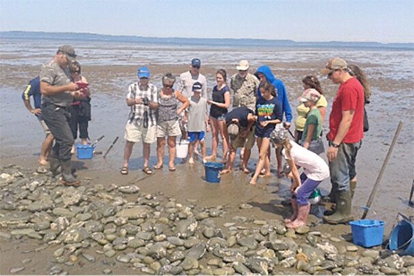
If learning to dig for clams sounds like fun, follow the link to the guided clam digging experience.

